Covering an area of 2,000 square kilometres, the Volcanic Geopark of Krong No streches from Krong No district to a number of neighbouring communes belonging to the districts of Chu Jut, Dak Mil, Dak Song, Dak Glong, Gia Nghia town.
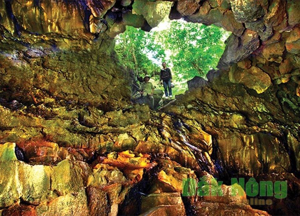
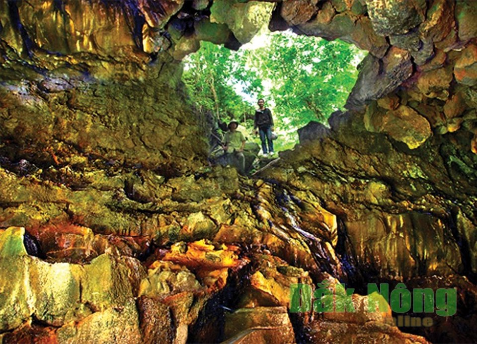
Inside the border of the Geopark, there are tens of caves of different sizes with total length of about 25 kilometres, measuring from the crater of Buon Choa volcano allocated along the Serepok river to the area of Dray Sap waterfall. Krong No volcanic Geopark houses 7 of the 10 types of geological heritages as classified by the UNESCCO. Its caves were valuated as the longest and most beautiful lava caves in Southeast Asian.
 |
| The lava cave in Dray Sap waterfall complex area |
One of the noticeable things is that the Geopark owns a lot of well-known beautiful sites. First to be named is Serepok river which is likened to a strip of white silk located in the Northern belt of the Geopark, with tens of waterfalls coming in different sizes. At the lower stream of the river, where the waterfall of Trinh Trinh Nu resides, there are large black basalt rocks in shape of pillars with geological age estimated at 2 to 5 million years emerging from the middle of the river or jutting our from the river banks with strange-looking figures.
Moving a number of kilometres to the river's upstream, there stands the waterfall of Dray Sap with the height of about 50 meters, stretching over a length of approximately 100 meters and barricading the Serepok river. Next to Dray Sap stands the waterfall of Gia Long of 40 meters of height and 40 meter of length. On one side of waterfall, there is a swimming pool of 80 square meter area, along with a very beautiful cave, all endowed by the Mother Nature.
The two waterfalls of Dray Sap and Gia Long waterfalls are well-known for being the most beautiful and mighty ones of the Central Highlands area. Lake Ea Sno covering an area of 80 ha at the very upstream and connecting with Serepok River is a natural reservoir with the primary and charming beauty of the landscape, surrounded by special-use forests, which is home to a wide ranges of trees as well as valuable and rare animals.
The natural preservation of Nam Nung of 12,000 ha has the highest peak of 1,500m, also the highest point of the South Central Highlands. Nam Nung was reckoned to be the "roof" of Dak Nong with its northern part tilting towards the Serepok river while its southern part tilting towards the upstream part of Dong Nai river.
From Nam Nung peak, the streams pour down to create the waterfalls, namely Ba tang (3-step), Bay tang (7- step) respectively depending on the number of steps among the flow of each waterfall. A major part of the Preservation is primative forests with a wide ranges of giant timbers, mainly comprising of Golden Oak, Lagerstromia, Apitong, etc.
The Natural Preservation of Ta Dung with the highest peak at 1,982 meters, lying among the Highlands of Mnong and Di Linh is the geographic and biological intersection in the South Central Highlands and Southeast Vietnam. The location has the Dong Nai river system passing by along with the Hydropower plants of Num ber 3 and 4, creating a reservoir of about 3,620 ha, among which emerges 36 islands of various sizes, and the beauty of which has been liken to that of the Ha Long Bay in Vietnam.
Inside the forest, the flowing by Spring of Dak N'teng forms 2 waterfalls of attractive and mysterious landscape. this location has biological diversity of over 1,000 botanical varietiesm, many of which are included in the Red list of Vietnam and the World.
The complex of the Krong No lava Geopark has a lengthy history, along with a lot of available tangible and intangible cultural herritage value such as: Central Highlands Goong Culture space, the epic of Ot Nrong, the set of festival culture, weaving brocades. the Ho Chi Minh path, the relic of Nam Nung resistance base from the time of Vietnam's resistance agains America, the relics of the heroes of N'Trang Long, N'Trang Guh in Vietnam's resistance war agains France in the early of 20th century.
Recently, a lot of archaeological relics, proving the residing of prehistoric man have been found in the lava caves in Krong No from the time of Late Old Stone Age (6000 years ago) to the Late New Stone Age and the Early Metal Age (4000 - 3000 years ago) which makes the location more of an attraction.
The land with such combination of diversity in terms of geology, geological heritages, biology, society, and cultural heritages as mentioned above has fully met criteria for an international Geopark. Especially, the complex of Krong No Volcano Geopark currently has 6 out of 8 national relics; 2 of which are well-known national beautiful site, including Dray Sap waterfall and Gia Long waterfall. Especially, almost all of the Nam Nung natural preservation and a major part of Ta Dung Natural preservation are inside the border of the Geopark. the mighty landscape is more remarkable than ever when taking into account the recently discovered lava caves system which is considered the longest and most beautiful of the Southeast Asia.
It's possible to say that, the space found in Volcano Geopark of Krong No is very ideal for the building of ecological and cutural tourism models. over the last years, the majority of beautiful sites and natural preservation in the area of volcanic geopark of Krong No have all been exploited as tourism facilities.
However, such tourism facilities are still moderate in terms of scales and investment forces. a great number of investment project in the field of tourism have yet to bring about real effect. the investment is carried out sparsely with no prominent touristic products. furthermore, the strategies for tourism development were yet to yield expected effect. in fact, the Geopark could be now considered a sleeping fairy that has potentials needed to be awakened.
In the coming time, the job of building and developing the Volcano Geopark of Krong No and exploiting the field of tourism still require a lot of work, especially attracting investment in such field. The foremost duty to step up is to complete the dossier of proposal to submit to the UNESCO for the recognition of the Geopark as Global Geopark; setting up the management commissioner in charge of and urging the work, planning and popularizing the potential and multifacet value of the Geopark.
Source: http://baodaknong.org.vn
Weather
| Đắk Nông | |
| Pleiku | |
| TP Hồ Chí Minh | |